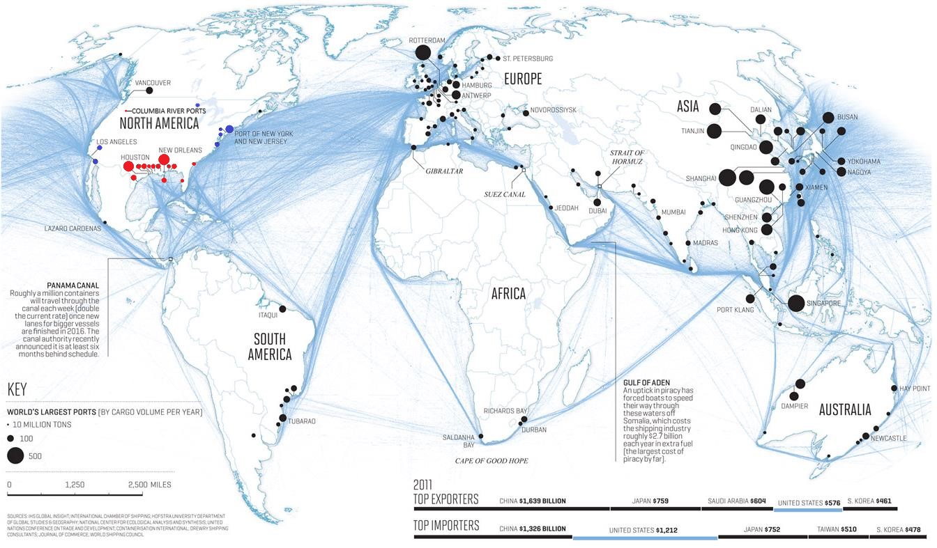
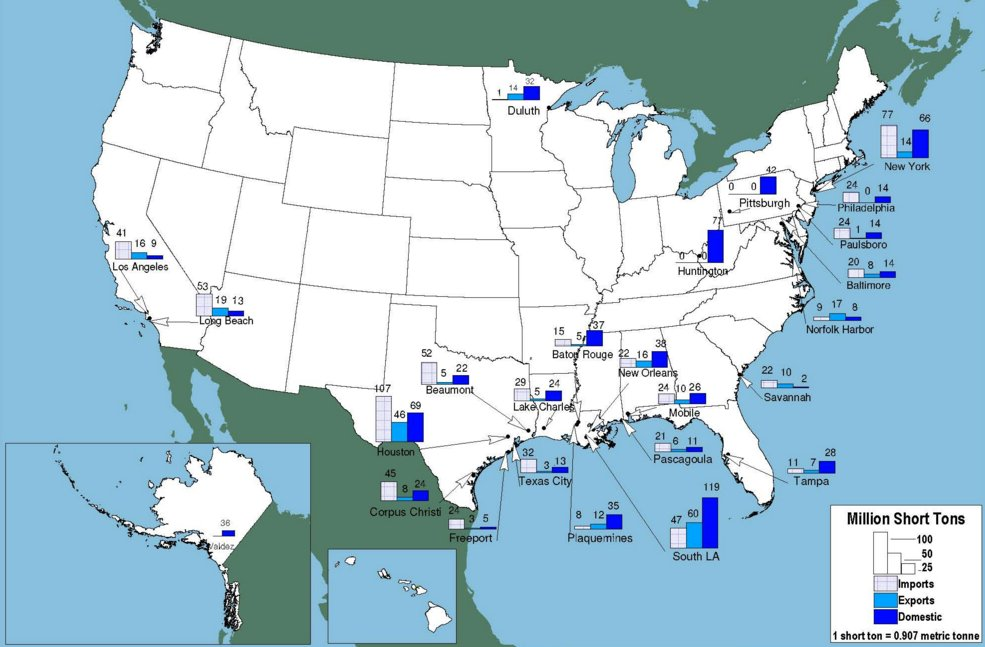
Blue state ports will be glad to have our business, but most of our bulk cargo sails down the Mississippi River system to red-state ports. The map above shows that red-state ports handle most of US shipping (measured by weight, not by value). Almost everyone in the red state federation will live in a state that is on the Mississippi River system (the ones that are colored blue here).
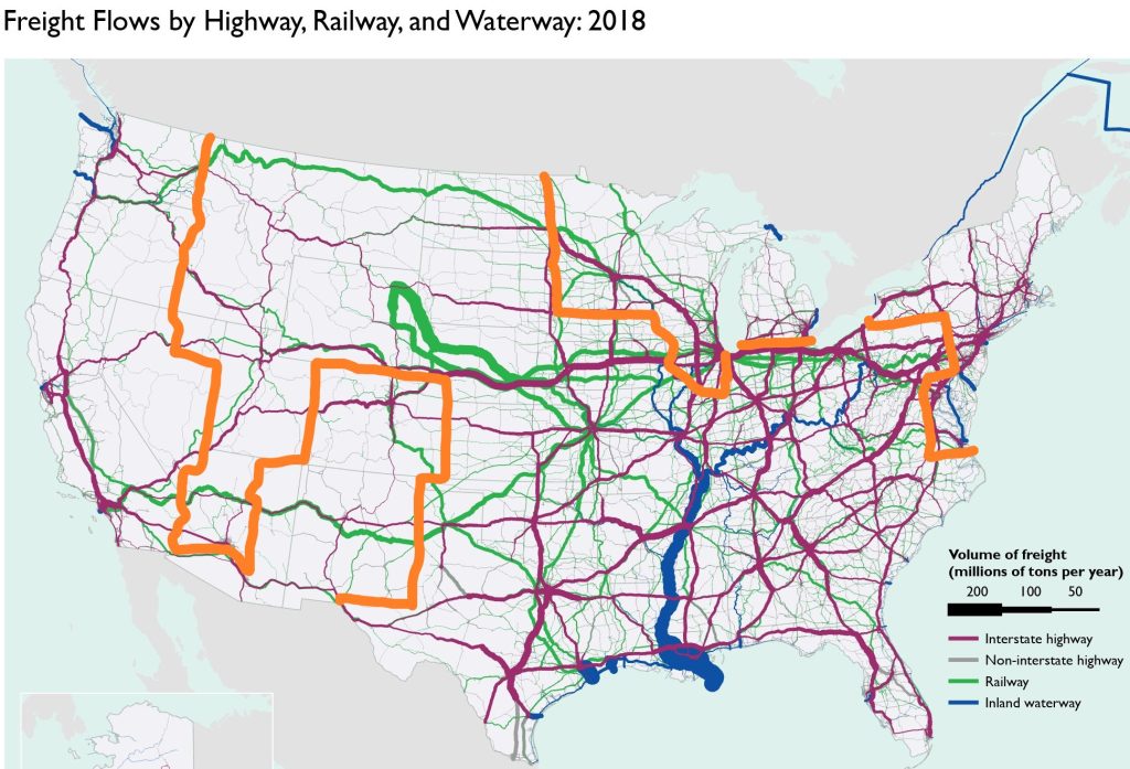
Not much cargo travels by river through Kansas City though because rail is king there. Absent war, Chicago would stay with the blue states, which means we’d be wise to build more rail from Kansas City to Indianapolis as far South as necessary to avoid blue states (in case of a temporary embargo). Other than that, our traffic will be fine.
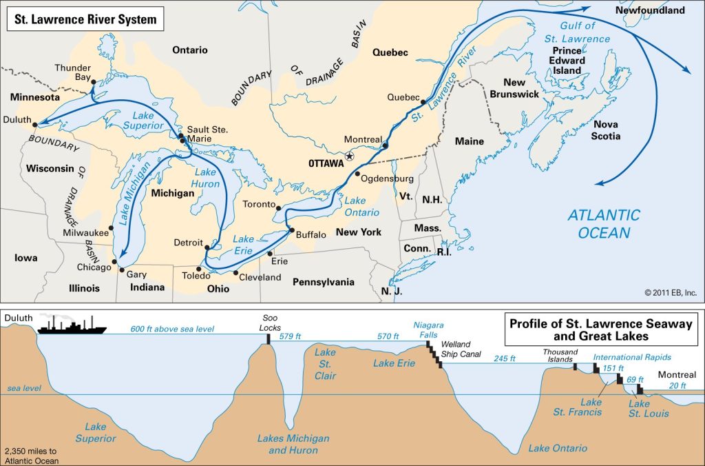
A red-state federation would have 9 coastal states, including Alaska. Additionally, Indiana, Ohio, & western Pennsylvania are on the Great Lakes, which have access to the North Atlantic via the St. Lawrence Seaway, which is only iced over for part of Winter.
We’ll have the Panama Canal, Guam, Alaska, and maybe Greenland etc. If we get a bit of northern British Columbia, we can use the highway there to get to southern Alaska’s port as Skagway (rather than all the way to Anchorage) without leaving our federation.
If blue states threaten to embargo us, we can embargo them, blocking land traffic from West Coast to East Coast – from Denver to Minneapolis/Chicago. They can’t afford to go without our portion of their supply chains anymore than we can afford to go without theirs. Besides, if blue states embargo us, we can use ports on the Pacific Coast of Canada or Mexico, or use the Panama Canal. If there’s war, we can take their ports in Oregon, southern Washington, and northern British Columbia.
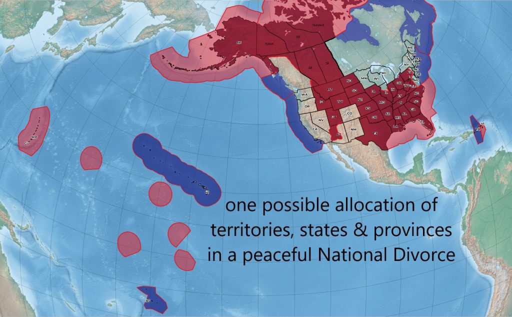
A US aircraft carrier’s draft is 37 to 39′. This is too deep for the locks on the St Lawrence Seaway, or the rivers to Idaho or Arizona, but not for any East Coast or Gulf Coast red-state. Some are Navy ports already. Here’s the MLLW port depths: North Carolina 42′ Charleston 52′ Savannah 47′ Jacksonville 47′ Port Everglades 42′ Miami 46′ Mobile 50′ MS (was Navy port until 2005) New Orleans 45′ Texas ports 56′. Anchorage, Alaska also has a very deep port which is ice-free year-round, although there can be floating ice in the sound at times to navigate around. Alaska has many ports, and we’ll probably inherit some of the US island territories such as Guam. The US Atlantic submarine fleet is already berthed in Georgia at the Florida state line.
Great infromation. After the Red States form their Federation we will have a strong trading network.